Saturday, October 9, 2021
Temp: 85/64, Humidity: 47/95%, Top Wind: Ne6 mph, Precip: FOG, cloudy, sunny, Miles Traveled: 122!!, Number of Locks: 1, – THE LAST ONE!!
****************************
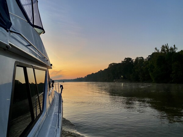
It was another early morning get up. We slept really good here on the dock at Bobby’s. No logs bonking our hull, we had air conditioning, it was very peaceful and dark outside. I should have gone out to look at the stars, but I’m always afraid of letting in too many skeeters that will consume all of Kenny’s blood. We had a beautiful morning pre-sunrise. There wasn’t any fog on the water. David had called the lock around 6:00, requesting a 7:00 lock through. The lockmaster didn’t answer the phone. Finally after several tries, he called on the radio. The lockmaster told him to call back at 6:30. Huh?🤔. That was weird. But, OK.
He talked to the lockmaster at 6:30, and he said to come on down, he’d get the gates open for us. So we pulled our lines and away we went. Thanks for the dock and power, Bobbys!
We arrived at the lock, and the gates weren’t open, but we only had to wait a few minutes. A fella walked across the gates, and they started to open, but then closed again. The fella walked back across to the building, then back across to his car, and bugged out. Then the gates opened. I think when we called at 6:00, it was shift change, and BillyBob didn’t want to mess with us since Homer was coming on duty. And then BillyBob forgot his coffee cup, so had to go back and get it. THEN the gates could open for us. 🤭 ha! At least, that’s the story we made up.
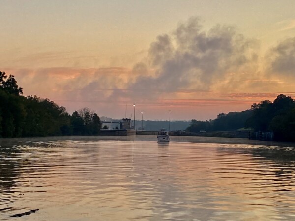
We were in and out in no time. I think this Coffeeville lock only dropped us down by about ten feet. It was a little mysterious watching the fog develop from the water spillway. We were hoping that it wouldn’t settle on the water.
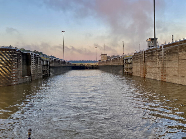
There was some turbulence coming down from the spillway, so we motored on out and went on our way at about 15mph!
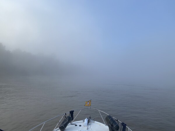
This was a lot cooler looking than how the picture turned out.
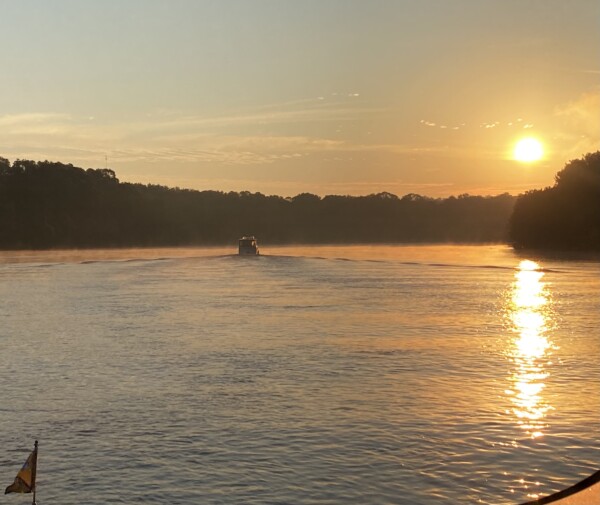
So far, so good with the absence of fog.
We were thankful there wasn’t a bunch of fog since there were some really big chunks of forest floating around.
But then…. there it came! It waited until 8:15 to settle down on us, and we had to navigate through fog for an hour or so. Sheesh! The nice thing about it, if there is one, is that it kept us cool. We had our jackets on. At least it wasn’t soaking wet thick kind of fog. We felt kind of damp, but my glasses didn’t fog over, and I didn’t have water dripping from my hair.
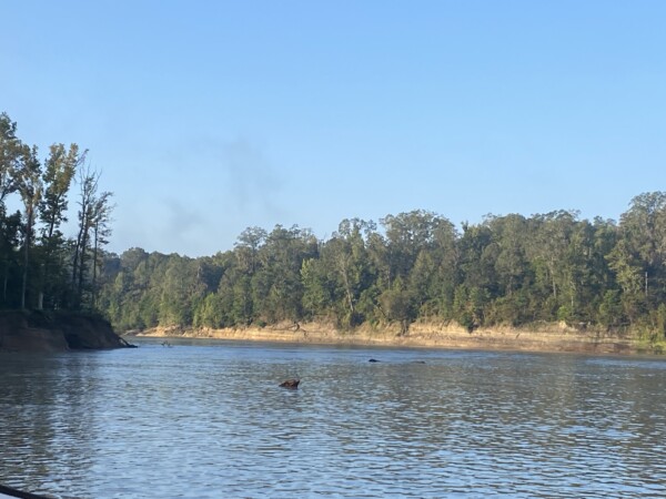
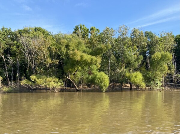
It did clear off and become a beautiful, and eventually pretty toasty day. I was trying to get a shot of the water level on the trees here. We saw lots of trees wading in the water, so that confirms that the water is higher than normal right now.
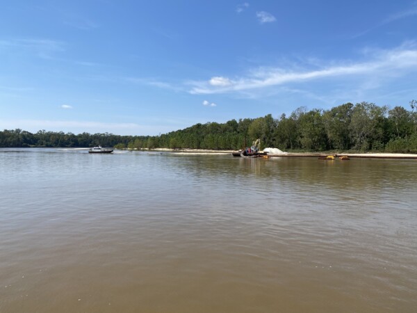
There were miles and miles of nothing but forest to look at. So when we finally came upon some activity, I had to take pictures. This was a big dredge operation. This tow was dragging this big pipe around behind him, and we had to squeeze between him and a channel marker on a corner.
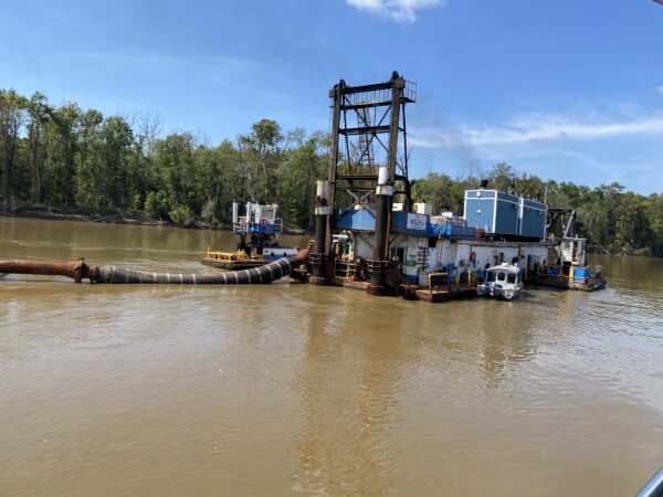
Here’s his pipe winding all the way around a corner.
At the end of the pipe is the discharge where they are creating a new big beach on the inside of the corner!
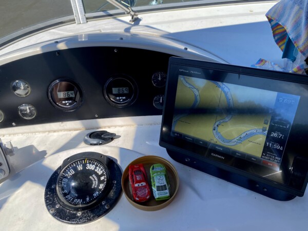
We went around the area at just above an idle speed according to the tachometer… only 864 rpm. That’s not far from the speed we use while in a marina. BUT – with the current, we were still going 9.69mph. We will miss the fuel economy that we get when traveling down stream. 😉
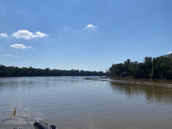
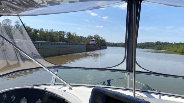
We passed a few tows today, and the marked channel isn’t always very wide! One time, we were heading into a corner, and the tow captain said he could see us, and wanted us to stay on the one. So we were on the inside. We saw him come around the corner so we stayed REALLY close to shore. The problem was, his bow wave on the barges was actually pulling logs and stuff OUT from shore, and there was a big tree with roots and another big log right in front of us. We slowed down, which was bad, because the tows judge everything they do based on everything staying constant. So when we slowed down, it messed up his trajectory and really left us in a skinny spot!! Thankfully we didn’t hit anything and came away unscathed. Whew!
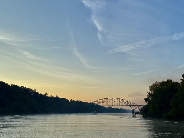
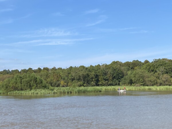
By 3:00 we were traveling through the lowlands above Mobile Bay. We saw several fishing boats, and went past the nice anchorage where we stayed last time.
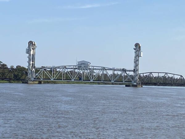
We were in a nice wide spot, so decided to roll up the turbos and go fast. But we came around a corner, and a railroad bridge that is normally open had a train on it. So we had to slow down again. At least the train didn’t take long, and we really didn’t have to stop and wait, just slow down.
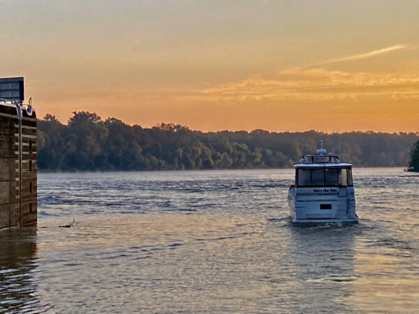
It wasn’t long before we could see the industrial district of Mobile. YAY! Miss Gladys and Navionics said we would arrive at our spot by 5:20. She’s the One was already there and celebrating the end of the rivers.
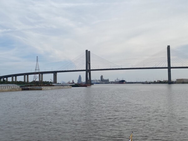
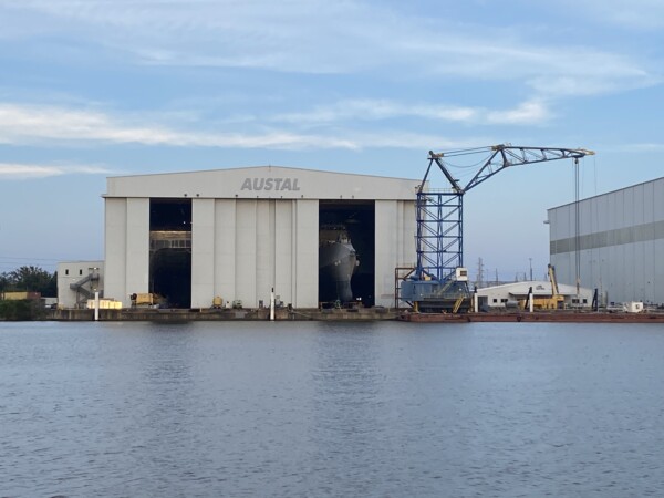
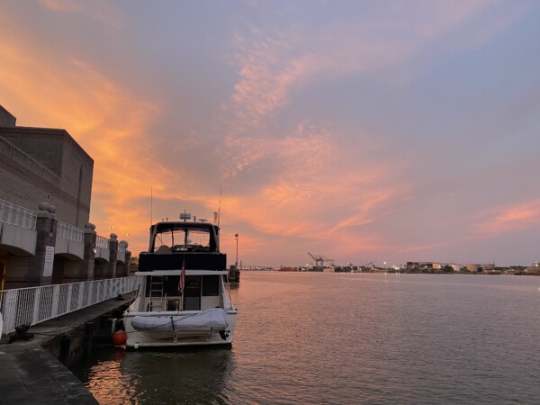
We pulled up to the Convention Center wall and got all tied up. WHEW! What a day! These strange super skinny ships were hiding in a building straight across from us.
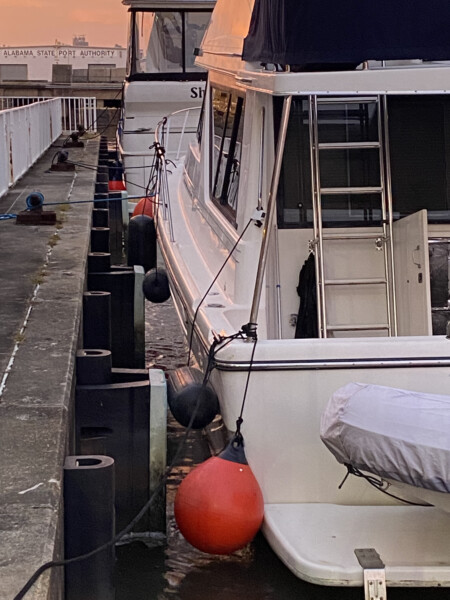
The wall where we tied up is really set up for commercial traffic. It has big giant square hard rubber bumpers on it, so we placed our fenders between Island Girl and the big squares. The rest of our fenders didn’t do anything but look like they wanted to help.
We had a magnificent sunset!
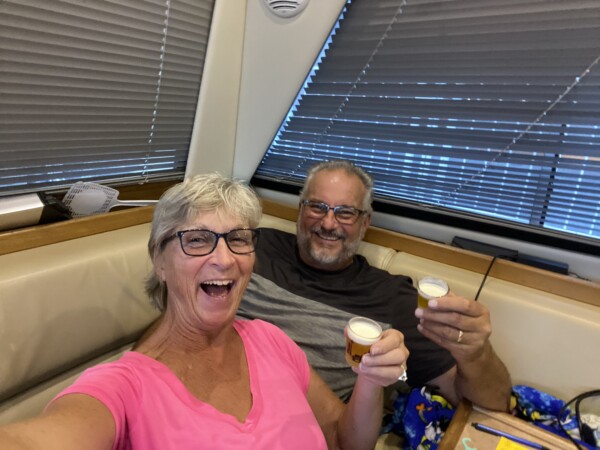
And we totally celebrated the end of the rivers with Little Beers. Oh my goodness! The rivers are not our favorite part of the trip, and it feels so good to be here!
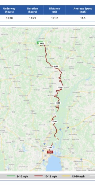
This was our very long voyage today. It was VERY squiggly, and we went every direction on the compass. There were several horseshoes in there. 122 miles in 10.5 hours underway. We were catching some really good current!
I’ve been watching the weather in the Gulf, and trying to estimate when we might want to cross from the panhandle to Clearwater. Some models show that Saturday 10/16 may turn out to be good. But not all models are in agreement. Forecasts are pretty good for three days, less reliable at five days, and some models won’t even go out beyond that, so not all models show all the way out to next Saturday. Wednesday was looking good, but we can’t reasonably get there by then unless we REALLY had to, and it would be painfully long days. So, we’re going to shoot for next Saturday at this point, and I’ve mapped out our stops across the panhandle based on that assumption. I called Lulu’s Homeport Marina in Gulf Shores Alabama this afternoon to make a reservation for tomorrow. That is about 45 miles from here. I’ll keep checking weather in case we want to speed up or slow down for a good crossing day. THAT voyage dictates every move we make now. We did 177 miles in 20 hours overnight in 2018, at 9mph. We vowed to never do that again, so we’re looking at crossing during the daylight, going fast, and getting it done in about 9 -10 hours this time. Shoot – we did 7 fast hours in the Atlantic when we ran the New Jersey coast 133 miles back in June this year. Two more hours and we could do the whole Gulf crossing, right? That’s what we think. And we have about 12 hours of daylight from dawn to dusk, so that’s the plan this time. 🤞
Cheers for little beers and finishing the rivers and locks!! what do you think about desolation sound next summer?
I’m thinking so! You better get a boat!
Sorry for the way late reply. I just got back around to keeping up (catching up!) with your travels. I’m glad you had a safe trip all the way home. I’ll have to catch up on your camping adventures.
The ship in the “barn” is a littoral combat ship, or LCS, of the Independence variant. https://en.wikipedia.org/wiki/Littoral_combat_ship The even-numbered hulls are built there by Austal. They are a trimaran configuration. The odd-numbered hulls are built in Marinette, Wisconsin, and are a more normal hull configuration.