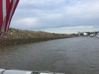
9/21/18 Friday: Remember that I told you that the water level had dropped here in the marina? We left our slip and the marina very, very slowly, but not so slow that the mud could grab us and not let us go! Doug from Misty Pearl yelled out “Don’t Stop – Keep going!” We churned up some mud, but got out just fine. Whew! You can see where the water line was just a few days ago. We heard from other southbound boats that were headed here that the marina called them and told them not to come due to the shallow water issue.
SeaJamm had called the Mel Price lock (just a couple of miles from here) at 6:30, and gave us a wake up radio call. The lock said they could take us any time. These Mississippi River locks are huge. They have one 1200’ long chamber for the big tows, and a 600’ long auxiliary channel, which we would be going in. It was raining, but looked to be clearing up around 9:00, so we all decided that would be a good departure time. We were going 85 miles total today, but with the Mississippi current, that should only take about 7 hours. And our destination is just a wall, with nothing to see or do, so no sense getting there way early in the day. Back to bed… that was just a snooze alarm. But then around 7:45, the call came – hey – how about we go at 8:15 since the rain was clearing out. OK! We’re on it!
We were at the lock in no time, and found it to be a complete floating forest! Good grief look at all this wood! This is still a commercial lock, so we had to find a floating bollard to loop a line around. (And the lock master was of no help at all for us little PC’s.). There are only six bollards in the lock, and the two ahead of us were not accessible through all of the floating forest, and the three on the port side were already taken. We took the back one on the starboard side, then we had two more boats join us in the lock! So we had one raft up with us, and the other rafted to another boat.

We tip-toed our way out of the mess, and were boat number 6 out of the lock. There was another lock in about 15 miles, just before St Louis that we needed to go through, so there was no sense trying to pass anybody. It was still really cloudy, but it didn’t rain, and the temperature was in the 70’s! NICE!

This is where the Missouri meets the Mississippi. We followed the sign that directed us down the shipping channel toward the lock. To go to the right on the main river here, we would have found rapids… not a good idea! This was about a nine mile channel, with the Chain of Rocks lock at the other end.

We saw nearly a dozen eagles along this channel! Most were bald eagles, and some were maybe golden eagles (no white head).

SeaJamm called the lock, and the lockmaster told us that if we’d get ahead of the downbound tows in the channel, he’d put us right through. So we kept our speed, but our slow little sailboat at the tail end was lagging. The lock master waited for them to get into the lock, and then the water was dropping before they even got set on a bollard. Island Girl went forward in this lock and rafted to SeaJamm. Only four of the six boats were going to Kaskaskia Lock wall today, (our destination) so we wanted to be in front to get moving along. The others were only going about 40 miles to Hoppies, which is a legendary stop. More on that later. Interestingly, the upstream lock wall raises up from the bottom, and that is as far up as it needed to go. We dropped about 3-4 feet in this lock.

Out and away we go! We were all done with locks on the Mississippi! Soon, we were approaching St Louis. There are several bridges across the river, and we could see the side profile of the arch to the right.

I am not sure what this is or WAS! It looked like something from a sci-fi movie like MadMaxx.

This is the Eades Bridge. I don’t think I told you about it yet. It was envisioned and financed by a young Andrew Carnegie. After the Civil War and the expansion of the nation’s railroad system, it became apparent that for St. Louis to survive, a bridge across the Mississippi River was essential. James Buchanan Eads was hired to build one. Eads was a self-educated engineer and had never built a bridge before. But during the Civil war, he had been called on by Washington to construct several Ironclad gun ships and completed his contract in an incredible 65 days. Eads Bridge is the world’s first steel-truss bridge, and an engineering marvel. Opened in 1874, it was one of the earliest long bridges built across the Mississippi, the world’s first all-steel construction, combined 2 levels for road and railway, and was built high enough so steamboats could travel underneath. The ribbed steel arch spans were considered daring, as was the use of steel as a primary structural material. This was the first such use of true steel (rather than iron) in a major bridge. It was the first bridge to be built using exclusively cantilever support methods. Skeptics did not trust this new fangled bridge design, so Eades came up with a plan. Popular belief held that elephants had instincts that would make them avoid setting foot on unsafe structures. So he hired a “test elephant” from a nearby traveling circus to take a stroll across the bridge. Onlookers cheered as the elephant crossed. Two weeks later, Eades sent 14 locomotives back and forth to further test it. And look – here we are, nearly 150 years later, and the bridge is still used for both cars and passenger rail. OK – that’s your architecture lesson for today.

This is a picture from Wikipedia. It really is a neat old bridge!

As we were approaching the arch, I pulled up a webcam internet site, so that we could watch ourselves cruise by! How cool is this?! I sent a text to our kids so that they could watch too. And then – I snapped a screen shot of us! TA-DA! How do you like that technology?! Look how tiny Island Girl is!! Can you even see her? That’s because the arch is so huge and we are just a little toy boat!

Traveling through the city, this three stack building was interesting. I don’t have any idea what it is, but the stacks were so tall!!

We did spy the Budweiser facility.

The river is not extraordinarily wide in the city, and there are a lot of tows and barges along the edges. Every once in awhile, there was one moving. We passed one that was going upriver. OH MY! Those big tows really churn up the river! We had 3-4 foot waves for about a mile! The wake just bounces back and forth from shore to shore, and the power of the engines pushing against the 3-5 mph current of the river just makes the river crazy with waves and current and whirlpools.

Here is a load of coal. They move a lot of coal around here to the power plants. Something has to make electricity to power the “clean” electric cars, right?

There were lots of logs and debris in the river to add to the fun. We had to have all four of our eyeballs peeled, on watch.

Pretty soon we saw some really interesting cliffs on the Missouri side of the river. Maybe in another couple thousand years, they could be cliff dwellings! These arches are carving themselves away in the stone, similar to what we saw on a very large scale last year down in southern Colorado at Mesa Verde National Park.

This river was movin’! We like to move it, move it!! At our normal cruising rpm, we go about 9.2 mph. And today we hit 14.3??? We have 5 mph of current?! Holy raceboat, Batman!! We are enjoying some really incredible fuel mileage – it’s like we’re coasting downhill for a loooong ways!

The scary part of this fast current, is that we were playing “disappearing marker buoys”. One minute you’d see it…

… and the next minute is was gone! When the markers went under, they created a kind of river rapid waterfall that was a bit different than most other stuff we saw on the river. So now we had to keep our eyeballs peeled for logs and submerged buoys. We could watch the chart and look for them – but many buoys were just missing. We saw dozens of them on shore where they’d either broken away or been run over and ripped loose by a tow, I suppose.

About 40-ish miles into our journey, we went past Hoppies. It is a tiny little old Missouri kind of place with a couple of old barges that act as docks. It is a common stop for many loopers, partly because it is the ONLY Marina for the next 225 miles, and the only place to get fuel for the next 100 miles. The other reason that loopers like it, is that it is iconic. The owners are a hoot, and Mrs Fern Hoppie is famous for her river briefings. She tells of river conditions and what to expect from here to where we turn off the Mississippi and onto the Ohio River. I’ve heard that she is quite the colorful river life character. She can be found smoking a cigarette on the fuel dock. If you ask her about it, her typical response might be something like “I ain’t blowed up yet!” We decided not to stop, since it was only about noon. We also know that this place is right on the river, and with the current running like it is, we could have logs and debris hitting us all night long, as there is ZERO protection. With the swift river current, we could easily go over 80 miles today, so we kept moving. The two boats that we picked up in the lock stopped here, and the four of us that started together in Alton continued on. (Island Girl, SeaJamm, Let’s Go, and Hayley Rose.)

Wow – more buildings from MadMaxx. You know – the post apocalyptic movies where everything is a shambles but people are still alive trying to stay safe from bandits and pirates and all kinds of demons and bad guys?

This was interesting. I don’t know what kind of plant this was – we saw so many power plants, and cement plants. But it had like pressure relief valves that shot water up out of pipes, high in the air. When we were approaching, it looked like a dancing fountain. And one of the pipes made a real loud sound when it went off. You just don’t see that everyday. A musical fountain in the river at an industrial site.

And then we saw … a castle? Hmmm – not your normal everyday house on the river in Missouri!

More cement. This was a huge pit, and they were loading a barge.

YAHOO! We arrived at our turn off. Our plan was to turn up the Kaskaskia (kas-KAS-kia ) River just a bit. There we would find a lock and dam which allows traveling boats to tie up for the night. Like I said, there are no marinas, and very, very few places that are safe to anchor out of the current and out of the way of the tows on this mighty Mississippi River. So this is a popular, common, and safe place to stop for the night.

SeaJamm was already there and tied up and had it scoped out for us. Gemini II was already there too – they came from Hoppies today. We met them in a lock back on the Illinois River Last week.

There was a big barge tied up to the lock wall, but there was room for 5 boats, which was perfect. We got ourselves all settled in. We didn’t do docktails, but we did visit for awhile and discover that all five of us were planning to go to the same anchorage spot tomorrow night. It’s kind of nice to travel together, so we all planned to leave around 9:00. Tomorrow’s journey will be about 68 miles, so no need to get up with the sunshine. We can do that in 5-6 hours easy.

We don’t have power, and we won’t have power tomorrow night either. That is primarily why we waited to leave Alton until today. The weather has cooled down, and we are no longer sweating buckets. We’ll be just fine without air conditioning. We opened up the windows, put in the screens, and enjoyed a nice comfortable evening. The water was calm here, with no debris and no tows going by. It’s a good spot.