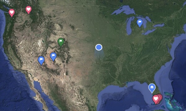
Sunday: This was a long 500 mile day, hitting three states, and going through Topeka, Kansas City, and St Louis. I could definitely see on the map and looking out the window that we were leaving the brown upper plains and entering the green heartland of the country.

The landscape in Kansas was a bit greener, and rolling hills began to show themselves.

We left Salina a little after 9:00, and decided to head on down the highway to catch a Starbucks about 45 miles away for coffee & breakfast on-the-go. By 11:00, we were passing through Topeka, which is the capitol city of Kansas. Here’s proof…. a double steeple church and a capitol dome.

Then, apparently Kansas decided that the Interstate 70 should have a toll charge on the route from Topeka to Kansas City. So we diverted and traveled state highways 40 and 10. We weren’t sure how the toll road worked, so with the help of Gladys (the ipad navigating), we found an alternate route. It was pretty, and moved right along without much traffic.

The highway 10 portion was actually a four lane freeway. Then – Yikes! This is approaching the interchange where we got onto I-435 to connect us back to I-70. That’s a lot of concrete after we’d been out in the toolies.

I kept watching the map to see where Kansas City got split in half between Missouri and Kansas. I thought it would be the Missouri River… but not on the freeway where we were. It was just a road called “State Line” that we crossed over. Even Google on Gladys welcomed us to Missouri!

And there’s our welcome road sign!

As we traveled through the eastern edge of the city, I spied the Kansas City Royals baseball stadium. Then right after I took the picture, I realized that the Kansas City Chiefs football stadium was right behind it. Oh well. Sorry I missed capturing both of them.

The countryside in Missouri was much the same as eastern Kansas. Lots of green fields, including corn and soybeans.

An electronic reader-board sign while driving I-70 through Missouri read: ”Camp in the Ozarks, not in the left lane.”
And then there was this one: “It’s a passing lane, not a cruising lane.” At least their DOT has a little sense of humor.

By 2:30, (5 hours 😳) it was time for a potty stop. The next one that I found on the map was this! Well…. better than nothin!

Before getting to St. Louis, I downloaded the WAZE app. I’d heard it was helpful, so I used it for awhile along with my Google map. It was pretty cool! It alerted us vocally for any police or stopped vehicles on the shoulder, etc. Hmmm… it might be a good one to use! So then I checked all of my navigation apps and found gas for $1.73 and routed us to a “dirt cheap” gas exit. My smart truck driver knew that gas would be more expensive in Illinois, so we made a gas stop just before we got to St Louis.
By 3:45 we were through most of the city of St Louis, and crossing the Mighty Mississippi River. There is a glimpse of the St Louis Arch, which we toured a couple of years ago.

The Missouri/Illinois state border runs down the middle of the river.

And we made it to Illinois!

We had not had any lunch, so decided on an early dinner at around 4:30 at Texas Roadhouse in Shilo Illinois. They were not providing any inside seating, so here was our dining experience. It was nice outside, and the food was really good.

It was just another hour drive to our stopping spot for the night in Mt. Vernon Illinois. Along the way, this was a typical scene.

Lots and lots of farmland.

We made it to our motel by 6:30, so it was over a 9 hour day with our stops for coffee/breakfast, potty, gas, and dinner. At least the long distance days are done for awhile, and now we have three shorter days with stuff to see and do coming up. 😁
P.S. Our elevation is now 505’ above sea-level. We should sleep good now! 😉